
The ability to navigate a 200-ton aircraft or a heavy-duty freight trailer within a margin of just a few centimeters is no longer a testament to human skill but a triumph of laser-based spatial intelligence. While the conversation around Light Detection and Ranging (Lidar) once centered exclusively on high-speed autonomous vehicles navigating city streets, the focus in 2026 has shifted toward the high-stakes world of low-speed industrial maneuvers. This precision positioning, often referred to as mastering the “final meters,” represents the critical interface where automated transit meets physical infrastructure. The technological evolution from simple proximity sensing to full volumetric awareness has fundamentally changed how global logistics, aviation, and maritime sectors perceive movement and safety.
Core Principles and the Evolution of Lidar Technology
Modern 3D Lidar functions as a remote sensing method that emits pulsed laser light to measure variable distances to an object. By calculating the time it takes for each pulse to bounce back, the system constructs a precise digital map of its surroundings. Unlike early laser scanners that provided a flat, two-dimensional slice of the environment, 3D Lidar captures a comprehensive spatial volume. This shift is significant because low-speed maneuvers, such as docking an aircraft at a gate or coupling rail wagons, require an understanding of height, tilt, and complex geometry that 2D sensors simply cannot provide. The move toward “walking speed” automation recognizes that most equipment damage and operational delays occur not during long-distance transit, but during these intricate final stages.
The “final meters” concept addresses a major bottleneck in industrial efficiency. In the past, legacy sensors like GPS and radar provided sufficient data for navigating open spaces, but they failed when precision was measured in centimeters rather than meters. GPS suffers from signal multi-path errors near large buildings, and radar lacks the resolution to distinguish between a docking latch and a nearby support beam. 3D Lidar fills this gap by providing high-fidelity environmental perception that remains unaffected by the “shadows” of infrastructure. It has evolved from a luxury experimental tool into a foundational utility, offering a level of reliability that human operators, subject to fatigue and perspective errors, struggle to maintain consistently.
Contextualizing Lidar within the broader sensor landscape reveals its unique value proposition as the only technology capable of providing “geometric truth” in real-time. While ultrasonic sensors are useful for basic obstacle detection at very close range, their lack of directional accuracy makes them unsuitable for complex alignment. Cameras, on the other hand, are highly dependent on lighting conditions and require massive computational power to estimate depth. Lidar’s active sensing approach means it provides its own “light,” allowing it to function with equal precision in the pitch-black environment of a warehouse or the blinding glare of a desert tarmac.
Technical Foundation of High-Resolution Spatial Awareness
Volumetric Point Cloud Generation
The technical superiority of 3D Lidar lies in its ability to generate dense point clouds, which are essentially three-dimensional data sets representing the external surface of objects. By firing hundreds of thousands of laser pulses per second across multiple vertical channels, the sensor creates a “digital twin” of the environment. This volumetric data allows the system to identify the specific shape and orientation of a target, such as the exact angle of a trailer’s kingpin or the curvature of a ship’s hull. This level of detail is a drastic improvement over 2D scanning, which can be easily “fooled” by hanging obstacles or uneven ground that falls outside its narrow horizontal plane.
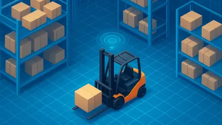
In complex industrial environments, the ability to interpret volume is a safety requirement rather than a feature. For instance, a 2D scanner might detect a person’s legs but miss a protruding forklift blade at chest height. 3D Lidar captures the entire scene, ensuring that autonomous systems account for every dimension of a potential obstacle. Moreover, the density of the point cloud allows for advanced filtering algorithms that can distinguish between a solid object and environmental noise like steam, exhaust, or heavy dust. This robust data stream is what enables machines to perform high-precision tasks without the constant need for manual intervention or resets.
Precision Alignment and Environmental Perception
Achieving centimeter-level accuracy for docking and coupling is a matter of high-fidelity data alignment. When an automated vehicle approaches a loading bay, the Lidar system compares the real-time point cloud against a pre-existing 3D model of the bay. This allows the software to calculate the “pose” of the vehicle relative to its target with extreme precision. The resulting data informs the vehicle’s control system, allowing for micro-adjustments in steering and braking. This is where Lidar outperforms camera-based systems, which often struggle with depth perception and can be rendered useless by shadows, rain, or lens flares that obscure visual markers.
Environmental resilience is a key performance characteristic that separates Lidar from its competitors. In 2026, the industry has seen Lidar hardware become increasingly hardened against the elements. Modern sensors utilize specific wavelengths that penetrate fog and precipitation more effectively than visible light. Furthermore, the active nature of the laser means the system does not require external illumination to “see.” Whether it is a midnight shift at a port or a snow-covered rail yard, the Lidar sensor maintains a consistent data output. This reliability is vital for maintaining high-throughput operations where downtime due to weather is not an option.
Emerging Trends in Low-Speed Automation
There is a noticeable transition occurring as industries move away from manual, operator-led maneuvers toward fully digitalized, sensor-driven workflows. This trend is driven by the realization that human error is the primary cause of minor collisions and equipment wear in logistics hubs. By removing the variability of human judgment, companies are achieving a state of “operational consistency.” This means that every docking maneuver is executed with the same optimal path and speed, reducing fuel consumption and extending the lifespan of expensive machinery. The focus is no longer on how fast a vehicle can move, but on how reliably it can interface with the next stage of the supply chain.
The rise of “Plug-and-Play” Lidar integration has also lowered the barrier to entry for many industrial players. Previously, implementing 3D spatial awareness required a bespoke team of roboticists and software engineers. Today, standard interfaces and pre-configured perception software allow Lidar to be integrated into existing industrial infrastructure with minimal friction. This democratization of the technology is accelerating the shift toward real-time spatial intelligence. As a result, even smaller logistics operators can now deploy autonomous mobile robots (AMRs) and automated yard trucks that interface seamlessly with conveyors and charging stations.
Furthermore, the industry is seeing a move toward decentralized spatial intelligence. Instead of sending all raw point cloud data to a central server for processing, modern Lidar units often incorporate edge computing. This allows the sensor itself to identify objects and calculate distances, sending only the necessary commands to the vehicle’s control system. This reduction in latency is critical for precision maneuvers where a delay of a few milliseconds could result in a hard contact rather than a soft coupling. High-throughput logistics now demand this level of immediate response to maintain the flow of goods in a global economy that operates 24/7.
Real-World Applications in Critical Infrastructure
In the aviation sector, gate management has been transformed by the upgrading of Advanced Visual Docking Guidance Systems (A-VDGS). By integrating 3D Lidar, these systems can now ensure that aircraft stop at the exact position required for passenger boarding bridges and fuel lines to connect. This precision is essential because even a small misalignment can prevent a bridge from extending or, in the worst-case scenario, cause the bridge to strike the aircraft’s fuselage. The use of Lidar has significantly reduced the time required for aircraft turnarounds, directly increasing the capacity of crowded airport terminals without the need for physical expansion.
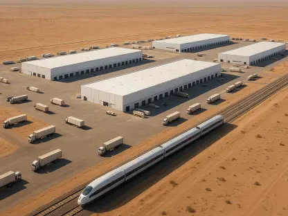
Yard operations in the logistics sector have similarly benefited from the automation of trailer coupling. Traditionally, reversing a tractor unit to meet a trailer was a time-consuming task that required high skill and multiple attempts. With Lidar-driven positioning, the vehicle can autonomously determine the trailer’s orientation and height, aligning the fifth wheel perfectly on the first try. This capability reduces bottlenecks in distribution centers where hundreds of trailers are moved every day. The consistency of these automated movements ensures that loading docks are utilized at their maximum efficiency, preventing the “yard congestion” that often plagues large-scale logistics operations.
The maritime and rail sectors are also undergoing a modernization phase. In dynamic port environments, 3D Lidar provides the visibility required for massive cranes to interact safely with moving vessels and automated guided vehicles. In the rail industry, the Digital Automatic Coupling (DAC) initiative is leveraging sensor-driven perception to automate the mechanical and digital connection of freight wagons. This is a significant shift for an industry that has relied on manual labor for coupling for over a century. By providing an accurate awareness of the track infrastructure and wagon positions, Lidar is enabling the rail sector to compete more effectively with road transport in terms of speed and reliability.
Technical Challenges and Market Obstacles
Despite its clear advantages, the high initial capital expenditure (CAPEX) for sophisticated 3D Lidar hardware remains a significant hurdle for many organizations. While prices have decreased as the technology matured from 2026 to the present, the cost of outfitting a fleet of hundreds of vehicles can still be substantial. Companies must balance this upfront cost against the long-term savings in labor and reduced damage. Moreover, the integration of Lidar requires an investment in the surrounding digital infrastructure, including robust networks and updated control software, which adds another layer of financial complexity to the adoption process.
Processing the massive amounts of data generated by a high-resolution Lidar sensor is another technical challenge. A single 128-channel sensor can produce millions of data points per second, which must be analyzed in real-time to be useful for navigation. This requires powerful onboard processing and sophisticated software algorithms to filter out noise and identify relevant objects. While edge computing has mitigated some of these issues, the requirement for real-time spatial analysis continues to push the limits of current industrial computing hardware. Organizations must also consider the cybersecurity implications of these data-heavy systems, as they become integral to the safe operation of critical infrastructure.
Regulatory and safety standards also present a complex landscape for automated movements in shared human-machine spaces. As robots and autonomous vehicles become more common in warehouses and ports, the rules governing their interaction with human workers are still being refined. Ensuring that a Lidar-driven system meets all safety certifications while remaining efficient is a delicate balancing act. There is a constant need for mitigation efforts through improved software algorithms for noise reduction to ensure that the system does not trigger “false positive” emergency stops, which can bring a productive facility to a standstill.
Future Outlook and Technological Trajectory
The future of 3D Lidar positioning is likely to be defined by the shift toward Solid-State Lidar and further miniaturization. Unlike traditional mechanical Lidar, which uses rotating mirrors, solid-state designs have no moving parts, making them more durable and cheaper to produce at scale. This will allow for the integration of high-resolution sensing into smaller robotic platforms, such as last-mile delivery drones and small internal plant AMRs. These breakthroughs will likely lead to a standard industrial utility where 3D perception is as ubiquitous as a simple camera is today, further strengthening the resilience of global supply chains against labor shortages and operational disruptions.
Integration with Artificial Intelligence (AI) will also play a pivotal role in the next generation of spatial intelligence. By training AI models on massive sets of Lidar data, systems will become better at predictive obstacle avoidance. Instead of just identifying an object, the system will be able to predict its likely path and intent. For example, a Lidar-equipped forklift will be able to distinguish between a stationary pallet and a worker who is about to step into its path, adjusting its trajectory proactively. This level of intelligence will transform Lidar from a passive measurement tool into a proactive safety and efficiency partner in the industrial workspace.
Over the long term, the transformation of Lidar into a standard utility will lead to a more interconnected and transparent global economy. When every piece of equipment in a logistics chain can “see” and communicate its exact position, the entire system can be optimized as a single, fluid entity. The “walking speed” economy, while less flashy than high-speed transit, is the foundation upon which global trade is built. By mastering the final meters through 3D Lidar, industries are creating a future where movement is not just about getting from point A to point B, but about doing so with a level of precision that was once thought impossible.
Summary and Assessment
The adoption of 3D Lidar technology proved to be the decisive factor in overcoming the long-standing inefficiencies of the “final meters” in industrial transportation. By moving beyond the limitations of legacy sensors, organizations successfully transitioned to a model of operational consistency that prioritized precision over raw speed. The ability to generate and interpret volumetric point clouds allowed machines to navigate complex environments with a level of accuracy that surpassed human capability. This shift did not just improve safety; it fundamentally altered the economic landscape of logistics, aviation, and maritime operations by reducing the high costs associated with equipment damage and manual errors.
In the years following 2026, the strategic value of 3D Lidar became increasingly clear as it evolved from an experimental luxury into an essential industrial utility. The integration of high-fidelity spatial data enabled the automation of high-stakes maneuvers that were previously considered too difficult for machines. As a result, the global supply chain became more resilient, and the “walking speed” economy reached new levels of throughput and reliability. The decisive verdict on Lidar is that its greatest impact was found not on the highways, but in the quiet, precise movements of the world’s most critical infrastructure hubs. This technological foundation will continue to serve as the primary driver of industrial efficiency for the foreseeable future, ensuring that the final meters of any journey are handled with mathematical certainty.