
With decades of experience navigating the complex world of supply chain and delivery, Rohit Laila has seen the logistics industry transform from a game of maps and stopwatches into a high-stakes technology race. As an expert who bridges the gap between traditional freight operations and cutting-edge innovation, he understands that the ground beneath the industry is quite literally shifting. Today, we sit down to discuss a pressing crisis: the deteriorating state of road infrastructure and how advanced mapping technology is becoming the only shield against escalating operational costs and systemic delays. We explore the hidden financial burdens of potholes, the limitations of standard navigation, and the data-driven strategies required to keep fleets moving when the roads themselves seem to be working against them.
With road repair backlogs in the UK reaching nearly £18.62 billion and fixing them estimated to take over a decade, how is this infrastructure crisis specifically threatening the survival of logistics companies operating on thin margins?
The sheer scale of a £18.62 billion backlog is almost impossible to ignore when you are responsible for a fleet of heavy-duty vehicles. When we look at a timeline of 12 years just to clear the current mess, we aren’t just talking about a few bumpy rides; we are talking about a permanent shift in how we calculate risk. For a carrier, a single pothole isn’t just a minor annoyance; it represents a potential £590 repair bill for damage more severe than a simple puncture. In an industry where we fight for every penny of profit, these unexpected costs for distorted wheels or broken suspensions can immediately derail the financial health of an entire quarter. We are seeing a “grave concern” move from the boardroom to the driver’s seat, as 80% of all domestic cargo in the UK relies on these crumbling roads, making the entire economy vulnerable to the next deep crack in the asphalt.
Many people assume a pothole only results in a flat tire, but you’ve highlighted a much deeper “domino effect” of infrastructure damage. Could you walk us through how a single road defect can disrupt an entire supply chain?
The moment a vehicle hits one of the estimated one million potholes on our roads, a clock starts ticking that costs the company far more than the initial repair. It begins with the physical jar to the chassis, but it quickly evolves into vehicle downtime, which is the silent killer of logistics efficiency. If a damaged wheel takes a truck out of service, that vehicle isn’t just sitting in a shop; it’s missing its warehouse slot, failing a customer promise, and breaking an onward connection for a time-sensitive load. We also have to consider the administrative nightmare of re-routing other assets and managing the “avoidable work” that follows an incident. For high-value or specialist loads, the vibration alone from poor road surfaces can compromise the integrity of the cargo, turning a routine delivery into a total loss.
Given the risks involved, why is the traditional reliance on local driver knowledge and consumer-grade GPS apps no longer sufficient for modern commercial fleets?
The days of relying on a driver’s “gut feeling” or a basic mobile phone app are quickly coming to an end because those tools don’t understand the physical constraints of a commercial vehicle. Consumer apps are designed to find the fastest route for a car, but they often ignore the reality of low trees, narrow lanes, or height restrictions that can trap a heavy goods vehicle. When a driver is forced into an unsuitable diversion because of a closed or damaged road, they face the immense pressure of improvising in unfamiliar territory. We believe that commercial-grade mapping is the only way to turn that scattered operational knowledge into a repeatable, safe standard for every driver, regardless of their experience level. The best route is rarely the shortest one anymore; it is the one that meticulously balances mileage against known hazards and vehicle-specific requirements to ensure the load actually arrives in one piece.
Since road-condition data is often fragmented across different local councils, how can transport teams build a “source of truth” to protect their assets from recurring infrastructure defects?
Because there isn’t one perfect external database that tracks every pothole in real-time, businesses have to become their own data scientists. We encourage fleets to stop treating incidents as one-off events and start aggregating internal damage reports, telematics data, and direct driver feedback into a central system. By layering this information with council maintenance histories and traffic patterns, a planner can start to see a “risk picture” that isn’t visible on a standard map. This proactive approach allows a team to identify specific stretches of road that consistently cause suspension issues or delays, enabling them to adjust route selection before the next truck heads out. It’s about using technology to map your way around the risks you can see coming, rather than constantly reacting to the damage after it has already occurred.
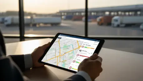
How does the implementation of digital geofences and real-time visibility change the way a logistics manager supports a driver who encounters an unexpected road hazard?
Real-time visibility acts as a safety net that bridges the gap between the office and the cab, especially when a driver is forced to deviate from a planned path. By using detailed digital geofences and site-specific attributes, managers can see exactly when a vehicle is entering a problematic area, whether that’s a flooded ford, a high-crime zone, or a route with strict local ordinances. If a driver takes an unplanned turn to avoid a new pothole, the system can instantly alert the transport team, allowing them to provide proactive support regarding weight or height limits on that new path. This eliminates the guesswork and helps the team understand if a deviation was a justified safety move or an unnecessary risk. Ultimately, this level of detail helps us refine future planning based on hard evidence, ensuring that our “baseline” for safety is constantly improving.
What is your forecast for the UK logistics sector over the next decade as it continues to grapple with these infrastructure challenges?
I foresee a significant “digital divide” emerging between companies that treat mapping as a luxury and those who recognize it as a core survival tool. As the repair backlog continues to stretch toward that 12-year mark, the cost of operating on UK roads will only increase, making manual planning completely unsustainable. We will see a shift where “commercial-grade” data becomes the standard, with autonomous systems and human planners working together to avoid high-risk zones entirely. The companies that thrive will be those that prioritize “safe miles” over “short miles,” using every scrap of telematics and infrastructure data to shield their margins from the literal cracks in the system. Success will no longer be measured just by how fast you can deliver, but by how intelligently you can navigate a landscape that is increasingly stacked against you.