
The sheer physical force of a heavy-duty commercial vehicle colliding with a low-hanging concrete overpass serves as a violent reminder that modern logistics requires more than just a standard map to function safely and efficiently. This recurring nightmare for fleet managers and drivers alike is not merely a product of individual negligence, but rather the visible result of a massive data gap in the tools provided to those who navigate our highways. As the complexity of our supply chains increases, the margin for error narrows, making the distinction between consumer-grade directions and professional-grade intelligence a matter of public safety.
The evolution of freight transport has reached a point where traditional navigation is no longer sufficient to manage the immense variables of the road. Specialized navigation has transitioned from a luxury for long-haul carriers to an essential component of the national infrastructure safety net. By providing drivers with a digital co-pilot that understands the physical dimensions and legal restrictions of their specific vehicle, these systems have begun to close the gap between outdated infrastructure and modern commercial demands.
The 6,000-Bridge Problem: A Modern Logistics Crisis
In the United States alone, approximately 6,000 bridges are struck by commercial vehicles every year, turning routine deliveries into catastrophic infrastructure failures that ripple through the economy. These incidents are rarely the result of simple driver distraction; instead, they represent a fundamental failure of information delivered at the critical moment of decision. When a forty-ton tractor-trailer is guided onto a parkway with low stone arches designed for early twentieth-century passenger cars, the resulting bridge strike does more than just peel back a trailer roof.
The consequences of these collisions trigger a cascade of road closures, massive repair bills, and long-term structural damage to the public transit network that can take months or even years to fully remediate. The financial toll on a carrier is often devastating, involving not only the immediate loss of equipment and cargo but also astronomical insurance premium hikes and potential legal liabilities. This recurring crisis highlights the urgent need for a shift away from casual, consumer-based navigation toward specialized, industrial-grade routing that respects the physical reality of the road.
Beyond the immediate structural impact, these accidents erode public trust and create significant safety hazards for motorists who happen to be in the vicinity of a strike. A single misplaced truck can paralyze an entire metropolitan area, causing thousands of hours of lost productivity for commuters and emergency services. Addressing this modern logistics crisis requires a comprehensive understanding of why these vehicles end up in such precarious positions in the first place, pointing directly to the tools used for pathfinding.
The Dangerous Mismatch Between Passenger Apps and Commercial Reality
The core of the issue lies in the data gap between consumer-grade GPS applications and the operational requirements of a professional driver. Standard platforms like Google Maps or Waze are engineered for efficiency in passenger vehicles, prioritizing the shortest or fastest path without accounting for physical or legal vehicle constraints. For a CDL holder, the fastest route suggested by a consumer app may inadvertently lead to a residential street with strict weight limits or a tunnel where hazardous materials are strictly prohibited.
Using these consumer tools forces drivers into a reactive mode, where they must perform high-risk maneuvers simply to avoid a physical impossibility that the application failed to predict. When a driver encounters a low bridge or a weight-restricted road that was not flagged by their navigation, they are often left with no choice but to back up onto a busy highway or attempt a U-turn on a narrow shoulder. These desperate actions significantly increase the likelihood of secondary accidents and create dangerous environments for all road users.
Furthermore, passenger applications often ignore the legal status of roads, treating a narrow residential boulevard the same way they treat a designated truck route. This mismatch creates a constant tension between the driver’s goal of reaching a destination on time and the legal necessity of staying on approved paths. Professional drivers require a system that understands a truck is not just a larger car, but a complex machine with unique requirements for turning radii, braking distances, and height clearances.
Essential Intelligence: The Features Defining Specialized Truck Navigation
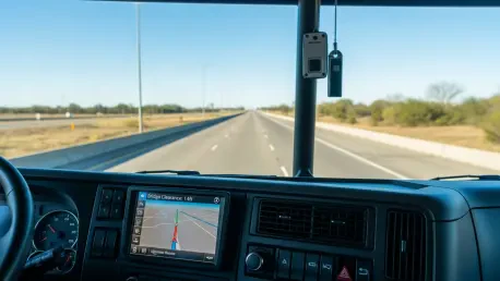
Professional-grade navigation systems differentiate themselves by prioritizing vehicle characteristics over simple destination coordinates. A viable commercial GPS must function as an intelligent co-pilot, incorporating several functional pillars to ensure safety and compliance across diverse operating environments. The most critical of these features is bridge clearance and over-height alerts, which utilize a comprehensive database to steer drivers away from structures that cannot accommodate their specific trailer height before they ever enter a dangerous situation.
Weight-aware routing serves as another vital pillar, integrating legal load limits into the algorithm to avoid structural damage to bridges and prevent heavy fines for the carrier. These systems also account for regional restrictions that prohibit specific hazardous materials in tunnels or densely populated zones, ensuring that specialized cargo follows the safest possible path. Real-time weigh station integration further assists drivers by providing live status updates on openings, which allows for better trip timing and ensures regulatory compliance without unnecessary stops.
Robust offline capability remains a non-negotiable feature for professionals who often travel through remote areas where cellular reception is unreliable or non-existent. By storing map data locally, these systems ensure that navigation and routing remain functional even in the most isolated corridors, preventing a driver from losing their way in unfamiliar territory. These integrated features transform the navigation tool from a simple map into a comprehensive management system that safeguards the driver and the vehicle.
Shifting from Reactive Guidance to Proactive Safety Ecosystems
Industry experts and safety analysts view the move toward specialized navigation as a strategic evolution rather than a mere technological upgrade. The current standard for connected vehicle technology has moved the needle from simple turn-by-turn directions to intelligent route planning that anticipates problems miles in advance. The financial impact of this shift is substantial; by avoiding unnecessary detours and preventing strikes, fleets have significantly reduced insurance premiums, fuel consumption, and vehicle wear and tear.
This proactive approach changes the nature of the driver’s job, allowing them to focus on the road rather than worrying about the hidden obstacles that a consumer app might overlook. When a navigation system understands the operational reality of the vehicle, it transforms into a preventative safety tool that protects the driver’s license, the carrier’s bottom line, and the integrity of public infrastructure. The shift has created a more predictable and stable environment for the logistics industry, which is essential for maintaining thin profit margins and ensuring on-time deliveries.
Moreover, the integration of real-time data allows for a more dynamic response to changing road conditions, such as weather events or sudden construction projects. By merging infrastructure data with vehicle-specific constraints, these ecosystems provide a level of situational awareness that was previously impossible. This technological maturity has set a new baseline for what is expected of a professional transport operation, making the use of specialized tools a hallmark of a responsible and efficient carrier.
Strategic Implementation: Choosing the Right Navigation Partner
To effectively mitigate risk, fleet operators and independent drivers have moved beyond basic user interfaces to evaluate the depth of the data architecture supporting their navigation. A successful implementation strategy involves selecting tools based on granular vehicle profiling, allowing for the input of exact vehicle height, weight, width, and axle count. This level of detail ensures that the routing engine can provide truly customized paths that are safe for the specific equipment being used.
The most effective platforms are those designed from the ground up for heavy-duty freight operations, rather than modified versions of existing passenger apps. These purpose-built architectures prioritize comprehensive data coverage, specifically focusing on bridge height accuracy in both urban and rural settings. Legality-focused routing has also become a priority, as systems must prioritize the actual legal status of roads for commercial use over the perceived speed or distance of the route.
Fleet managers who prioritized these specialized tools established a culture of safety that paid dividends in both operational efficiency and driver satisfaction. They recognized that the cheapest navigation option often carried the highest hidden costs in terms of fines and accidents. By investing in high-quality, data-rich partners, carriers ensured that their teams had the best possible information to navigate a complex and often unforgiving transportation landscape.
The transition toward specialized navigation became a benchmark for excellence across the logistics sector as companies finalized their move away from inadequate consumer tools. Fleet operators who successfully integrated these systems achieved a significant reduction in roadside incidents and streamlined their compliance protocols. They demonstrated that the digital profile of a vehicle was just as critical as its mechanical maintenance for ensuring safe passage. These industry leaders concluded that proactive routing technology was the most effective defense against the mounting challenges of aging infrastructure. This evolution established a new standard where data-driven safety was no longer optional, but a fundamental pillar of commercial success.