
With decades of experience navigating the complexities of the logistics and supply chain industry, Rohit Laila has developed a keen eye for how technology can revolutionize the movement of goods and information. Now, he’s at the forefront of a new venture that turns a massive delivery fleet into a powerful, real-time data collection network. In this discussion, we explore how thousands of delivery vans are being transformed into roaming sensors, the critical process of ensuring data privacy in a GDPR world, and how this high-frequency stream of street-level imagery is poised to reshape everything from smart city infrastructure management to the development of next-generation driver-assistance systems.
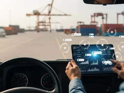
With plans to cover 21 European countries by mid-2026 using your delivery fleet, could you detail the process of outfitting these vans with connected dashcams and managing the massive flow of image data you are already collecting across millions of kilometers?
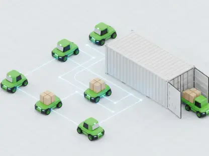
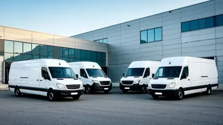
It’s a significant undertaking, but one we’ve approached with a very deliberate, phased strategy. We started by equipping several thousand vans within our existing fleet of over 65,000 vehicles, focusing first on 11 key countries. The beauty of the system is its passive nature; our drivers simply follow their routine delivery routes, and the connected dashcams do the work. The real magic happens on the backend, where we’ve built a robust pipeline to ingest, process, and manage the terabytes of image data flowing in daily. Every kilometer driven contributes to this ever-growing visual database. We’re already seeing the results across millions of kilometers, creating a uniquely dense and current view of Europe’s road networks.
You emphasize that all imagery undergoes automated anonymization to be GDPR compliant. Can you walk me through the specific steps your system takes to remove personal identifiers and how you validated this process to ensure full compliance before providing data to clients?
Privacy is not just a feature for us; it is the absolute foundation of this entire venture. From the moment the imagery is captured, it enters a secure, automated workflow. Our proprietary algorithms are specifically trained to identify and permanently blur personal identifiers—primarily faces and vehicle license plates. This isn’t a manual review process; it’s an integrated, instantaneous step in the data pipeline. Before we even considered offering this data to partners, we subjected the system to exhaustive testing and third-party audits to validate its effectiveness. We had to be certain that our anonymization met the highest standards of GDPR, ensuring that the valuable data we provide on road infrastructure is completely free of any personal information.
The data will be supplied via APIs to clients like mobility companies and smart-city operators. Could you share a specific use case or metric on how a partner might leverage your high-refresh-rate data to validate a road network or monitor infrastructure conditions?
Absolutely. Imagine you’re a city planner responsible for road maintenance. Instead of relying on sporadic public complaints or annual inspections, you could tap into our API. Our vans might pass down a particular street five times a week. You could use our data to detect the formation of a new pothole or the degradation of lane markings in near-real-time. This allows for proactive, targeted maintenance, saving money and improving safety. For a mapping provider, our data is invaluable for validation. They can instantly verify if a new traffic light has been activated or if road signs have changed, ensuring their navigation services are impeccably accurate.
Harnessing a fleet that travels over two billion kilometers annually gives you a unique high-refresh-rate capability. Can you elaborate on this advantage and provide an example of how quickly you can capture a change, like a new speed limit, compared to traditional mapping methods?
This is truly our key differentiator. Traditional mapping companies might send a specialized vehicle to survey a region once a year, or even less frequently. Their maps are static snapshots in time. Our fleet is in constant motion, covering the same urban, suburban, and rural roads daily. This creates what we call a high-refresh-rate dataset. So, if a municipality installs a new 30 km/h speed limit sign on a Tuesday, a traditional survey might not see it for another eleven months. One of our delivery vans on its regular tour is likely to capture an image of that new sign within a day or two. That change is then processed and flagged, becoming available to our partners almost immediately. It’s the difference between a map and a living digital twin of the road environment.
You are partnering with Nextbase and will be at CES 2026. What key capabilities does this partnership enable for your platform, and what specific developments or metrics do you hope to showcase to potential automotive or smart-city clients in Las Vegas?
Our partnership with Nextbase is fundamental to the entire operation; they provide the state-of-the-art camera and imagery platform that serves as the eyes of our fleet. It’s their hardware that ensures we capture crisp, high-quality, and reliable data across thousands of vehicles in all conditions. When we get to CES 2026 in Las Vegas, we want to make the scale and power of this platform tangible. We’ll be showcasing the live data feed, demonstrating how quickly we can detect and report changes. We’ll present key metrics on our coverage, our progress toward mapping 21 countries, and the precision of our AI in identifying everything from road signs to infrastructure that needs repair. The goal is to show automotive developers and city planners how this unprecedented stream of data can be directly applied to build safer driver-assistance systems and more efficient cities.
What is your forecast for the role of real-time, crowd-sourced street-level data in shaping the future of autonomous driving and urban planning?
I believe it will become absolutely indispensable—the central nervous system for smart mobility. For autonomous driving, a static, pre-loaded HD map is already becoming obsolete. A vehicle needs a dynamic, real-time understanding of its environment to safely navigate temporary construction zones, react to newly opened lanes, or account for a recently faded road marking. This kind of crowd-sourced data provides that vital layer of current reality. For urban planning, it will shift the entire paradigm from reactive problem-solving to proactive, data-driven management. Cities will be able to monitor the health of their infrastructure, optimize traffic flow, and plan future developments based not on decade-old census data, but on a living, breathing model of their community. It’s the key to creating safer, more reliable, and more responsive urban environments.